Hartsop Above How to Little Hart Crag
Distance: 13.6km (8.45 Miles)
Ascent: 960m (3150ft)
Duration: 4 Hours 30 Minutes
The weather was said to be best on the eastern side of the lakes today so it was over to Patterdale for me! This also gave me a chance to try out my new jacket on the hill.

Arnison Crag in the early afternoon sunshine.

Place Fell.

Gavel Pike and St Sunday Crag.

Birks and Arnison Crag, still a few stubborn patches of snow fairly low down.

Beautiful sunshine over Patterdale.

And again from higher up along the ridge to Hartsop Above How.

The view east to Rampsgill Head and Gray Crag.

Angletarn Pikes - the left one being the highest.

The ridge of Hartsop Above How and the far eastern fells.

Just look at the size of the cairn on top of Hartsop above How...

This time looking to Dove Crag and Hart Crag.

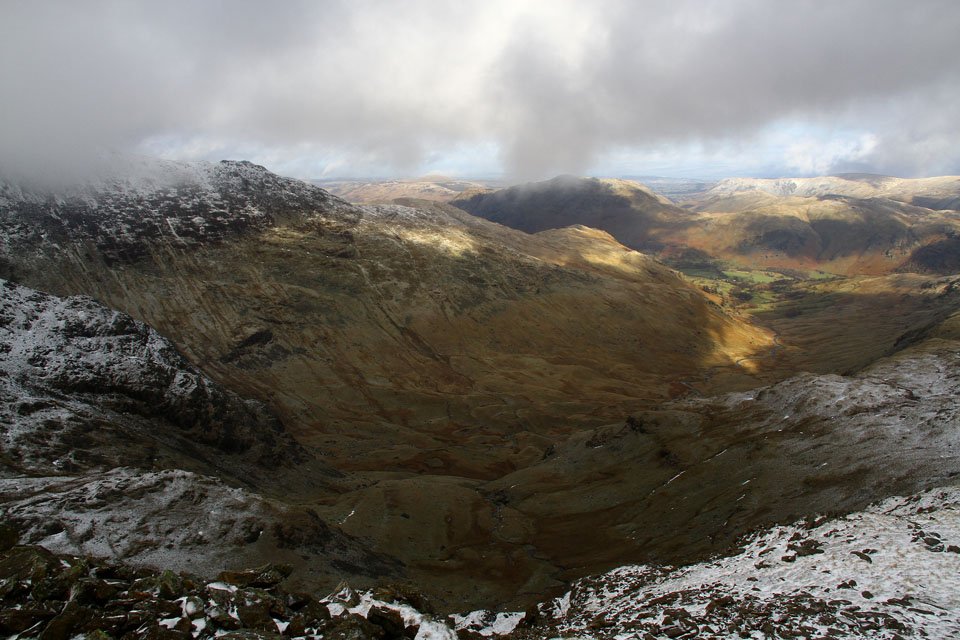
The head of Dovedale.

Heavy snow showers to the north east.

A view back along the entire ridge of Hartsop above How. Just before this photo was taken a mini twister went right over me and the winds picked up to about 50+ and the vortex travelled down the ridge for about 300m. It was quite a sight...
Deepdale.

Great Rigg and the central fells.

Fairfield from the summit of Hart Crag.

The view south to Windermere from Hart Crag.

Dove Crag - the next stop.

Great Gable and Pillar about 10 miles away.

Fairfield and Hart Crag.

Bright sunrays near the Coniston fells.

Dove Crag summit cairn - It was mighty windy up here!

Little Hart Crag.

High Raise, Rampsgill Head and Kidsty Pike.

Scandale and Scandale Tarn - I read on the internet somewhere that the tarn should be called Little Hart Tarn instead of Scandale Tarn because of its shape. I couldn't agree more! The photos was taken from Little Hart Crag.

Little Hart Crag cairn.

High Hartsop Dodd cairn.

The ancient settlement at the head of Dovedale. The earthworks clear as day from up here!

This photo was only taken to show how heavy the hail was!

Everything has a slightly lighter white tint to it now.

Just on the other side of this wall on the left is a dead sheep... And feeding on it was a Buzzard and I didn't even notice it until it flew about 5 metres from me over the gate and off away somewhere. I was gutted to not get a photo of it!

More heavy hail showers.

The ancient settlement from ground level.

And a last view to Brothers Water and Place Fell.