Fusedale Round
Distance: 15.0km (9.32 Miles)
Ascent: 989m (3245ft)
Duration: 4 Hours 55 Minutes
Today was probably the most settled day (weather wise) for about a week so it was out for a good length walk around Fusedale.

Lanty Tarn just a couple of minutes from Martindale Church at the start of the walk.

Sunshine! But this was all we got during the whole walk. It really clouded over after this with a few spots of rain.

The Nab looking very similar to a couple of fells near Brothers Water (Hartsop Dodd and Middle Dodd).

Steel Knotts summit, one of only a couple in the lakes only summited by climbing rocks... granted its nothing compared to Helm Crag in the central lakes, but its nice. The summit is also known as Pikeawassa.

Ramps Gill and Bannerdale either side of of The Nab.
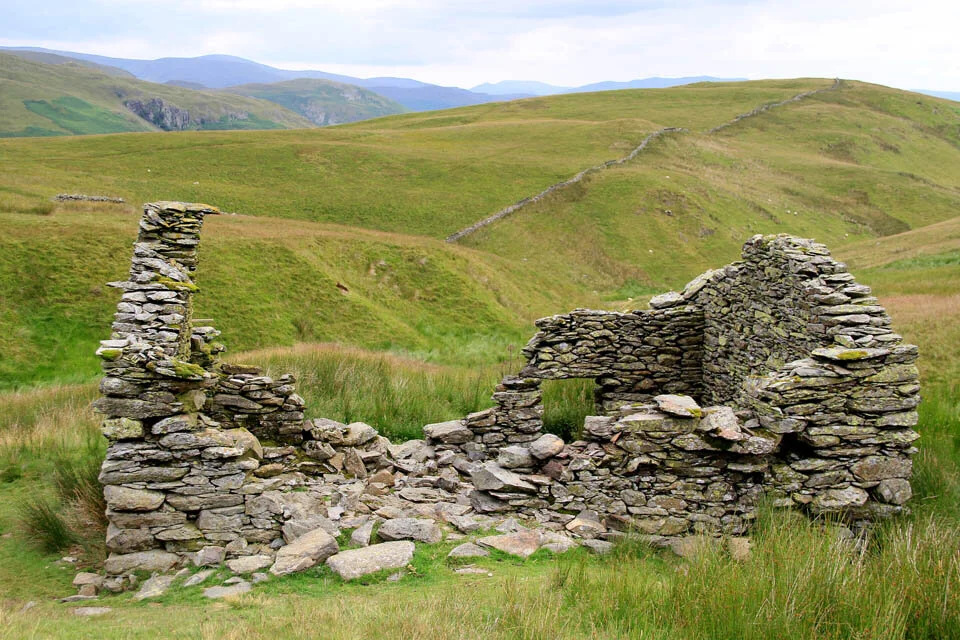
A ruined building on the way up to Wether Hill.

Distant Helvellyn and Catstye Cam.

Wether Hill summit cairn with the eastern lakeland fells behind.

The remains of Lowther House.

The highest point on Loadpot Hill just a short way from the Trig Col.

And the Trig Col on Loadpot Hill.

The somewhat unremarkable stone circle on the way to Arthurs Pike. I would note that according to the GPS (which is usually accurate to within 3m) showed the location of the stone circle to be very different to what OS have shown it as. Its about another 100m further north east of the marked location on the OS map. Unless this isn’t the stone circle…

Arthur's Pike summit and Ullswater.

Bonscale Towers seen from Arthur's Pike.

The route to Bonscale Pike took us past this sheepfold, with what appeared to be two gate posts and a window... Bit elaborate for a sheepfold...

On the summit of Bonscale Pike. Hallin Fell (in front) is the next and last fell of the day.

Descending steeply to Howtown with the best views of the day.

Now back at Martindale Church, and time for a quick nip up and down to Hallin Fell.

Hallin Fell obelisk and Ullswater snaking its way to Pooley Bridge and Dunmallard Hill.