Caudale Moor
Distance: 18.5km (11.49 Miles)
Ascent: 1372m (4501ft)
Duration: 5 Hours 55 Minutes
The first day of superb weather so I had a good walk planned around the whole of Hartsop - Unfortunately I had to change the plan slightly only because the legs couldn't quite hold up much longer!

Early on in the walk there was a little view over the trees to the crags around Dovedale with some promising sunshine.

Hartsop Dodd and the grassy ridge called Rough Edge leading up to Caudale Moor.

Reflections of Hartsop Dodd.

Caudale Moor and the rather well defined miners track that I will be taking up the side of Rough Edge. Some snow still sticking to the crags.

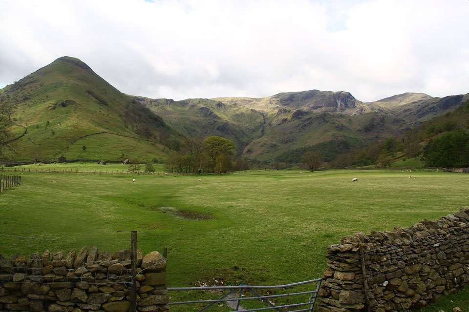
Following the path to Hartsop Hall and its completely flat along here. The view is of Middle Dodd and High Hartsop Dodd which look like twins from this angle.

Angletarn Pikes and Brock Crags - the original plan was to summit these two peaks as well as the four I actually completed today.
High Hartsop Dodd and the lovely Dovedale.

Dovedale again from slightly further along the path.

And again for a third time - this time from higher along the path up to Caudale Moor.

Sykeside, the long ridge of Hartsop Above How and a little bit of Brothers Water.

The beautiful Dovedale with Hart Crag, Dove Crag and Fairfield in the background.

Stunning views of Brothers Water and Ullswater from the old quarry in Caudale.

Shafts into the mountain - there was another further up which I could here a waterfall deep inside the fell.

Caudale Head and the last bits of snow from Winter.

Lovely views over the mines to Place Fell.

Brothers Water, Ullswater and Place Fell to the right.

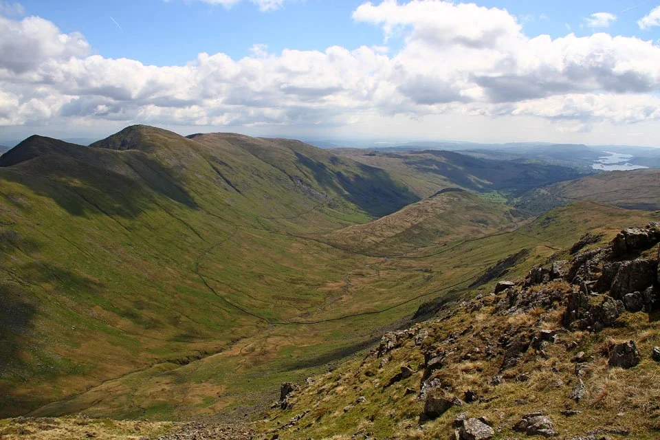
Caiston Glen surrounded by the steep sides of Middle Dodd and Little Hart Crag.

Place Fell and on the far right one of the summits of Angletarn Pikes.

What a contrast in weather from the last couple of days! Would have been nice to have it like this all the time I was here!

Ullswater backed by Watermillock Common and in the distance is Carrock Fell.

A panorama from Rough Edge.

Considering how hot it was up here I couldn't believe that the snow hadn't melted... When I got back to the car the thermometer said it was 28C in the sun and trust me it felt that hot out of the wind!

High Raise on the left with Rampgill Head in the centre and Kidsty Pike on the right.

The Helvellyn Range over High Hartsop Dodd.

Kirkstone Pass and Red Screes. It looks quite impressive from this angle.

Lake Windermere over St Raven's Edge.

Lots of effort later the view from the head of Caudale makes it worthwhile!

The very impressive Ill Bell Ridge.

My path down to Hartsop Dodd - once at the summit I headed back up the same way to Caudale Moor.

Arnison Crag which is where I was the day before yesterday.

Hartsop Dodd summit - time to gain another 150m.

Helvellyn and the pointed peak of Catstye Cam from Stony Cove Pike.

Stony Cove Pike (the summit of Caudale Moor). Here looking past the cairn to Thornthwaite Crag - can you see the beacon on the top?

Another shot of Stony Cove Pike summit this time looking north towards Blencathra (in the far distance!)
The lovely valley of Troutbeck flanked by the Ill Bell Ridge.

My next peak today; Thornthwaite Crag. The path on the left was pretty steep!
Full length view down Troutbeck to Windermere.

A small unnamed tarn at Threshthwaite Mouth.

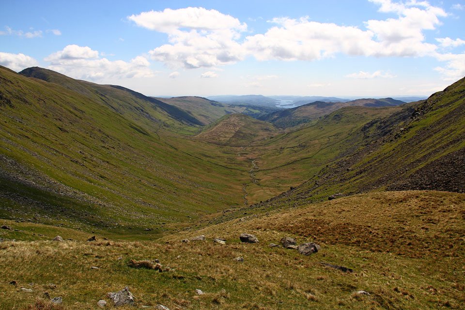
The quiet valley of Pasture Bottom and the impressive Raven Crag on the left.

Thornthwaite Crag ahead!

And the not so busy summit of Thornthwaite Crag - I think this was the quietest its ever been for me up here although it didn't last long as people were coming up doing the Kentmere Horseshoe.

A view to the Helvellyn Range over Caudale Moor and Hartsop Dodd.

The view south to Windermere.

Bowfell, with the Scafells just touching the cloud.

The Ill Bell ridge photographed earlier was the first part of the Kentmere Horseshoe and other than High Street and Mardale Ill Bell just off to the left, this photo shows the rest of the route over Harter Fell, Kentmere Pike and Shipman Knotts.

My route down to Gray Crag - I had this whole fell to myself today.

Hayeswater looks impressive from this angle, surrounded by steep fellsides leading up to The Knott and Rampsgill Head.

Gray Crag summit cairn.

From here the original plan was to head down to Hayeswater and then up to join the coast to coast and cut across to Brock Crags (on the far left of the photo) but the legs were getting tired and I had done 10miles to get to this point so I decided to head back to Hartsop.

Near Hartsop now and there is a great view up Pasture Bottom to Raven Crag and Threshthwaite Mouth.