Coledale Horseshoe
Distance: 15.2km (9.44 Miles)
Ascent: 1200m (3937ft)
Duration: 5 Hours 45 Minutes
A superb and sunny winter walk around Coledale visiting numerous Wainwright Fells.

Today the forecast wasn't too bad and as it's my last day off until Christmas I thought I'd go on a longer walk around Coledale. This photo was taken on the way up to Kinn and shows Dodd and the Skiddaw fells.

A view across Coledale to Stile End and Causey Pike.

Braithwaite and the Vale of Keswick far below. Clough Head and Great Mell Fell in the distance.

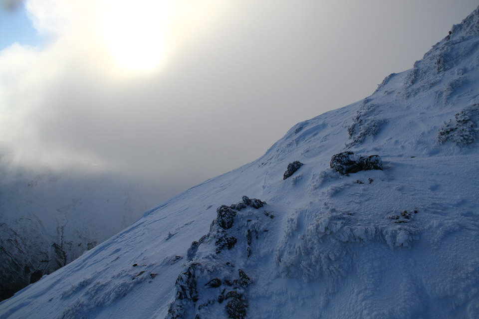
And my first view up Coledale. I hope the cloud lifts off Crag Hill when I get there!

A very wintery looking Grisedale Pike - and yes it was full winter gear on today!

Causey Pike across a frozen landscape.

By the looks of it I'm not the first up here... Come to think of it, it was very busy up on the fells today.

A view back down over Sleet How to Skiddaw and Blencathra.
Frozen icy rocks.

The summit of Grisedale Pike.

A panorama from Grisedale Pike.
Hopegill Head and Ladyside Pike from Grisedale Pike.

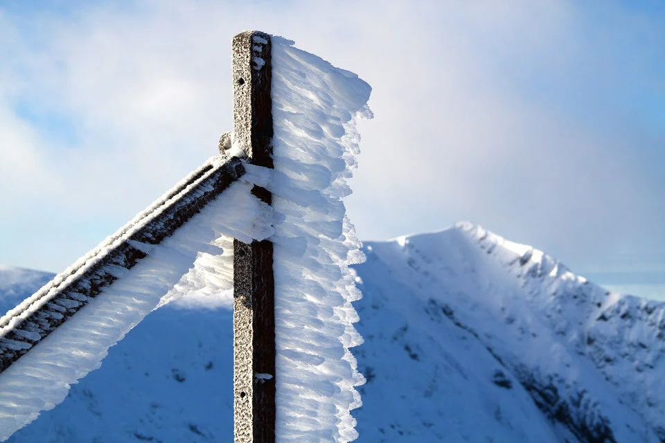
Frozen posts along the route to Coledale Hause.


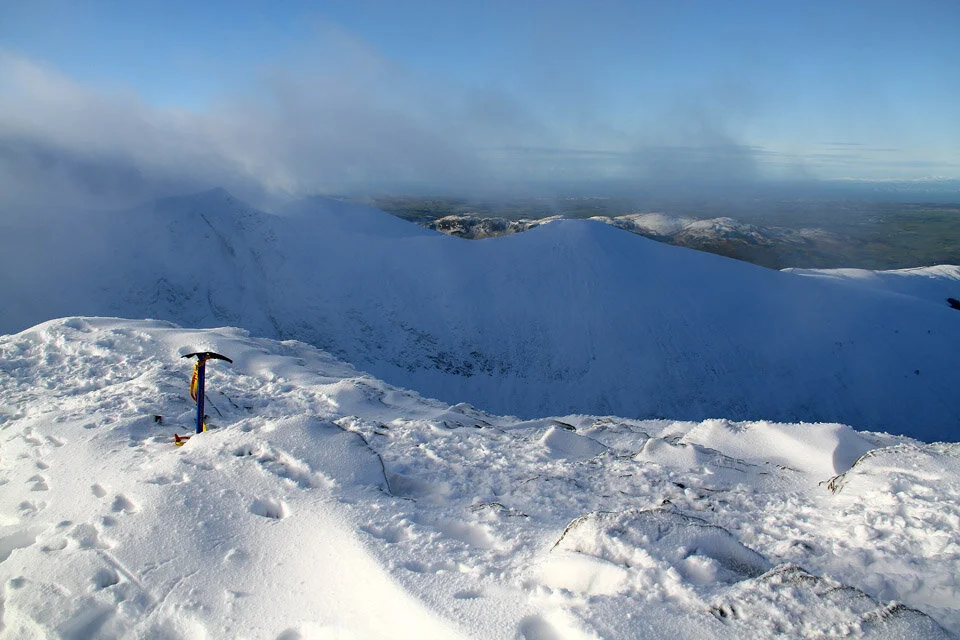
The Pennines just over 30 miles away.

Hopegill Head. I was going to head up to Hopegill Head and then back over Sand Hill but instead decided just to drop down to Coledale Hause.
My route headed over this subsidiary summit and over to the left to Coledale Hause.

Hopegill Head.

Mono shot looking east to the Helvellyn Range.


The valley of Hobcarton. Hopegill Head which is just out of shot to the left is also known as Hobcarton Pike.

The view back to Grisedale Pike with the Vale of Keswick to the right.


Eel Crag and Grasmoor. When I was walking along this section is was common for me to walk (unknowingly) into waist deep snow which was great fun.

Silhouetted Eel Crag. My route followed a path between this peak and Grasmoor.

Gasgale Crags and Whiteside.

Deep snow along the start of Liza Beck.

Wandope summit. By the looks of the snow I think I was the only person to visit the summit (so far) today.


Robinson and Knott Rigg from Wandope.

A panorama from Wandope.

Ard Crags and Knott Rigg, and on the other side of the fells; the Newlands Valley.

A grand and colourful view back to Wandope.

Close up of Wandope summit and a cornice formed around the edge of the fell. The high peak in the background is Pillar.

The distant Scafells.

A frozen Crag Hill summit Trig Column.


My route down and then back up over Sail.

High Snockrigg and the High Stile range - Wandope to the right.

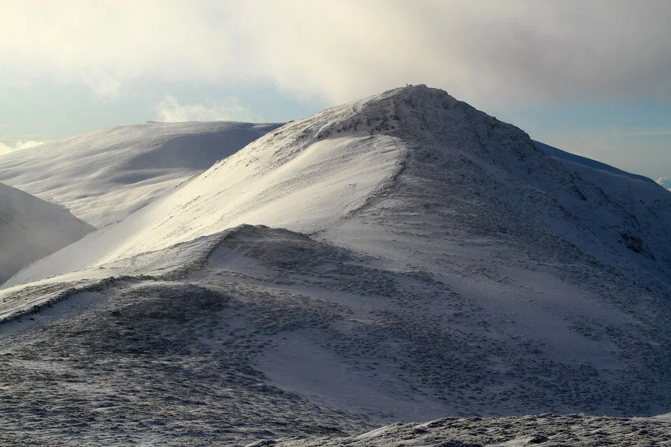
Grisedale Pike and Coledale.

That’s where I've just come from... It was a little tricky following the arete made almost entirely of snow...

A grand scene as the sun starts to set behind High Stile.

Sail summit with no cairn.

Crag Hill.

And a profile of Grisedale Pike.

The sun is getting ever lower and the snowy peaks are gaining a pink tint to them. From here my final section of the walk took me down to Barrow Door (just below Blencathra in the photo) and back to Braithwaite.