Cleeve Hill
Distance: 8.13km (5.05 Miles)
Ascent: 390m (1280ft)
Duration: 2 Hours 18 Minutes
Unfortunately I couldn't continue onto the Brecon Beacons as previously planned but wanted to get another walk in so opted for the Cotswolds and it was a good decision as the walk was stunning and I will look forward to returning here in the future.

A view down to Cheltenham from the quarry just below the Iron Age Fort.

Cotswold Way marker leading you to the Fort.

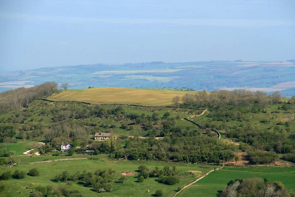
A view across the country of Worcestershire to the start of the Malvern Hills.

Superb weather and a superb view.

The large banks and ditches of the Iron Age Fort.

Masts just near the Trig Point on Cleeve Hill.

The highest point in Gloucestershire and the Cotswolds at 330m.


Splendid walking as I cross the open countryside towards the slightly lower (317m) north summit of Cleeve Hill.

Walking with a cast on - hats off to you! You can see the trig column up to the left.

The northern Cotswolds.

A view down the valley towards Winchcombe.


Now starting the little ascent to the north summit.

The north top of Cleeve Hill.

A seat with a cracking view! Perfect place to sit and have lunch.

A marker showing what hills and features are in what directions. Having just walked in the Malvern Hills I noticed there were some obvious mistakes in that direction!


Bishop's Cleeve down below and the Malvern Hills (Worcestershire Beacon is the highest) across the county.
Nottingham Hill with another Iron Age Fort on the top.

I was sitting down eating my lunch and was lucky enough to have a Buzzard fly really close being attacked by two crows. This was the best photo I could get of the Buzzard.

A panorama from Cleeve Hill looking to Bishop's Cleeve.


Castle Rock view - the only climbing area locally.

Cheltenham Racecourse.

Castle Rock.

A final view across Worcestershire to the Malvern Hills.