The Essex Way
Guidebook available in the shop!
Distance: 82 Miles
Start: Epping Train Station, Essex
Finish: Harwich, Essex
The Essex Way is a lovely 82 mile long distance trail across the county of Essex. Starting at Epping Station the route crosses vast open countryside to the coastal town of Harwich, visiting dozens of tiny villages, towns and historic points of interest along the way. The walk can conveniently be broken down into 9 day walks by using the local bus and train services to arrive back at the start of each day or with plenty of overnight accommodation, walk the route in its entirety over the course of a week.
Day 1: Epping to Chipping Ongar (13.3km)
Setting out today, I parked up at Chipping Ongar and got the bus into Epping as the cost of just a few pounds and began this lovely trail across Essex.
The very start of the Essex Way, this plaque is located on the side of Epping Station.
Only half a mile into the walk and I am already in the countryside. Not what I expected after starting at the end of a Tube Station!
Yesterday there was a lot of rainfall that I forgot to take into consideration making this next section rather wet underfoot.
It was FAR wetter than it looks in the photos. The path was saturated after torrential rain yesterday.
Even here the path looks dry... it wasn't!
Entering Gernon Bushes nature reserve.
The information panel.
Into the woods proper.
There were a few small ponds along the path through the woods.
Crossing the M11 via a footbridge allows for a view to the skyscrapers of London!
More open countryside on the other side of the M11.
Only a few houses for company.
Approaching Greensted Church just 1.1km away - a place I've wanted to visit for a long time!
Inside the oldest wooden log church in the world! Greensted Church. Reportedly Saxon!
Such a tiny church.
The oldest part is the log section in the middle.
Leaving the church along the Essex Way bound for Chipping Ongar and where the car is parked!
Day 2: Chipping Ongar to Salts Green (14.86km)
Day two saw me parking at Salts Green in a large layby and getting two busses, one to Rockwell Public House and then the other onto Chipping Ongar.
The town centre of Chipping Ongar and the start of the St Peters Way too.
St Martins Church in Chipping Ongar.
The Essex Way and St Peters Way (one I really want to do!)
So far the Essex Way has been very well waymarked.
Lovely summer weather along the way.
The newest of the two churches in Willingale.
The old church in the same churchyard.
Barley fields near Willingale.
The track to Salts Green where I had parked.
Day 3: Salts Green to Great Waltham (13.94km)
For part three I parked at Great Waltham and got a bus into Chelmsford and then a bus to Salts Green to pick up where I left off.
Good signposting along this section!
The lovely church at Good Easter.
Wheat fields nearly ready for harvesting.
Pleshey Church.
The best view available of Pleshey Castle earthworks. The bridge you can see dates to the 15th Century.
The enormous earthworks still filled with water.
A viewpoint to the earthworks in the village centre and perfect place to stop for lunch!
Complete with an information board.
Pleshey Castle Earthworks.
The local pub at Pleshey.
The route to Great Waltham.
A reservoir along the trail.
Great Waltham Church.
Day 4: Great Waltham to White Notley (21.23km)
For Part Four of the Essex Way I parked up at White Notley and got the train into Chelmsford followed by a bus to Great Waltham.
Great Waltham Church.
An interesting Tomb in the church yard.
Langleys country house.
A weir in the Langleys estate.
Leaving the Langleys Estate.
Little Leighs church.
A spring just along the trail.
Open fields on the way to White Notley.
Windmill at Flacks Green.
The ford and footbridge. Way too deep to drive through now!
Fairstead Church.
Crossing the River Brain south of White Notley.
The Cross Keys at White Notley.
Day 5: White Notley to Coggeshall (14.46km)
Part five had be parking in Coggeshall and getting the bus into Braintree followed by a train to White Notley to continue the trail.
Cressing Church.
Following the path through the fields away from Cressing Church.
Curd Hall Farm.
The lovely church of St Nicholas, dating to 1225.
The half way point!
The lovely arched doorway.
The ruins of Coggeshall Abbey are integrated into these buildings and houses.
Abbey Mill.
Coggeshall Church.
One of the lovely local pubs in Coggeshall.
The local hotel.
Paycocks House, 15th Century.
Day 6: Coggeshall to Horkesley (20.33km)
For Part Six I parked up at Horkesley and got a bus into Colchester followed by a second bus into Coggeshall.
Wildflowers along the trail.
Clouds are looking a bit dark over there! I hope it doesn't rain!
The church in Great Tey.
Crossing the railway into the Colne Valley.
One of many Pillboxes along this stretch.
Entering the woodland trust site.
Bergholt Hall.
West Bergholt Church.
Day 7: Horkesley to Manningtree (21.3km total from two separate walks)
To complete this section with the use of Public Transport park up at Manningtree and get a train to Colchester followed by the bus to Horkesley.
A beautiful small lake on the edge of Horkesley.
Following the path to Boxted.
Boxted Church.
A lovely view over the Stour Valley.
It was at this small lake I saw an Otter swimming about!
A little murky along the edge of the Stour Valley.
Langham Church.
The trail remains very well waymarked.
Dedham church.
The path towards Manningtree.
Day 8: Manningtree to Wrabness (12.37km)
A lovely day along the Essex Way. I parked at Wrabness and got the train to Manningtree.
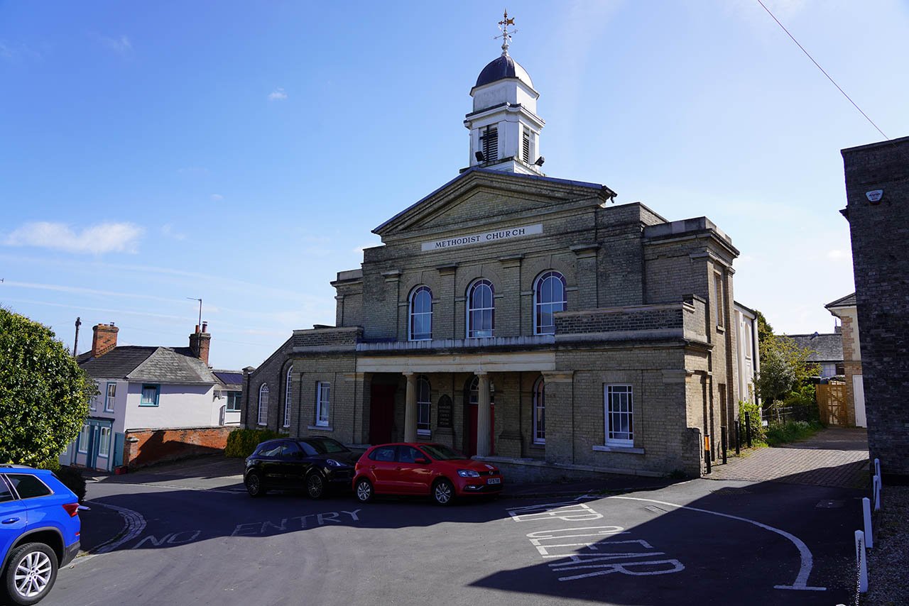
The Methodist Church in Manningtree.
The Red Lion.
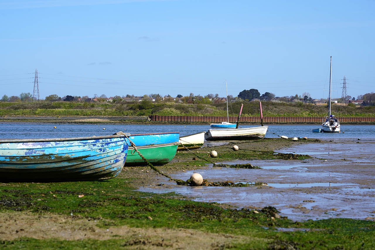
Now down on the edge of the Stour Estuary which is followed for a little way.
The Stour Estuary.
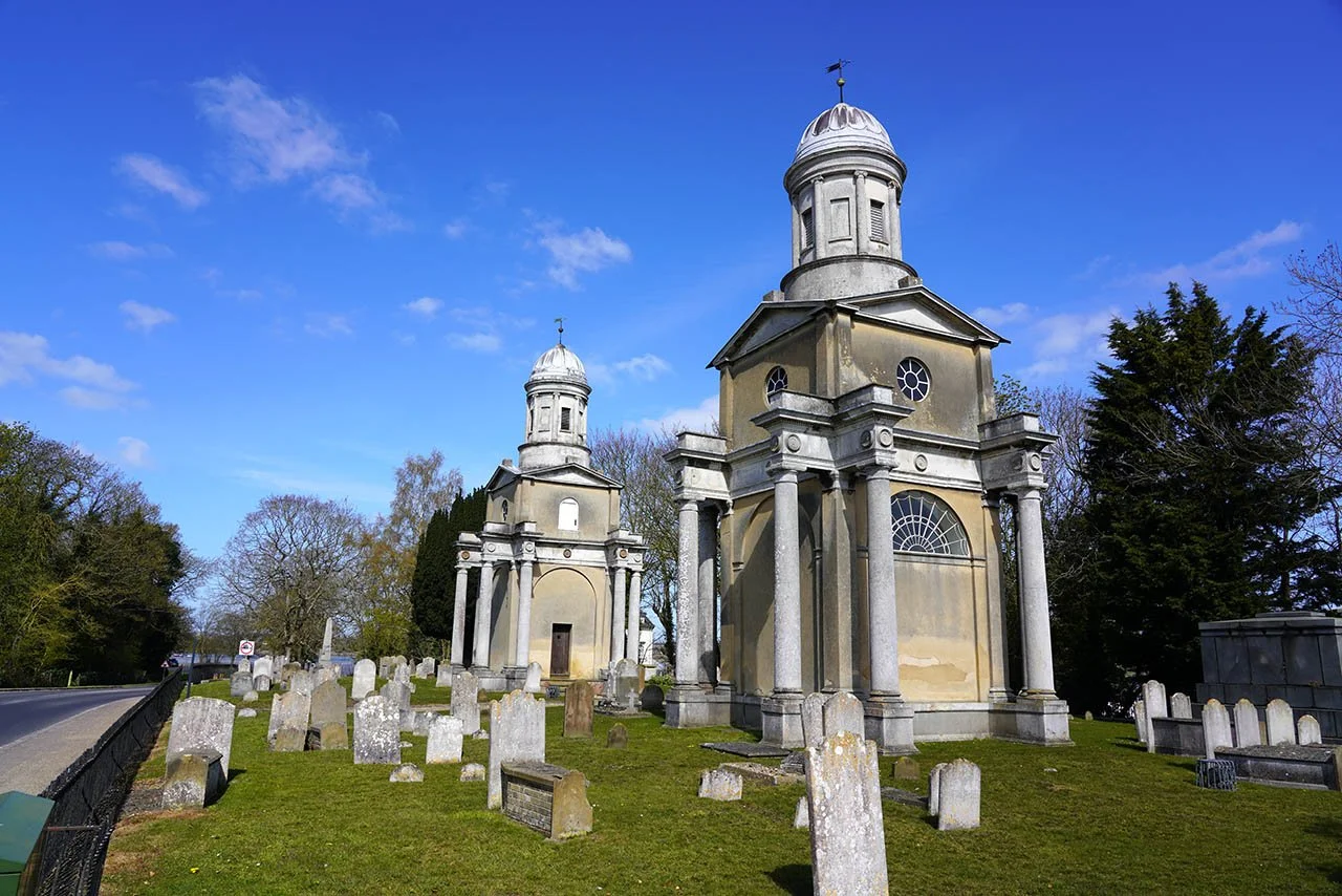
Mistley Towers.
The Mistley Thorn B&B.
A little stream near Mistley.
Massive fallen trees in nearby woodlands.
A distant view to the Stour Estuary and the tower of the Royal Hospital School.
The church in Bradfield.
Following the path down to the estuary once again.
The Stour Estuary. This was now followed for several miles past Wrabness Nature Reserve and then into Wrabness village.
The tower of the Royal Hospital School.
The view from Wrabness Nature Reserve.
Wrabness church.
From the edge of the estuary its only 500m up to Wrabness train station.
Day 9: Wrabness to Harwich (14.9km)
To avoid seeing any of the highlights in Harwich, I began part nine in the car park at Wrabness and walked the route to the coast and used the train service to get back to Wrabness.
Stour Estuary Nature Reserve.
Approaching Ramsey Mill.
Ramsey Windmill.
Now on the other side of Ramsey looking back to the mill.
My first view of the coast. The tower is at Walton on the Naze.
The vast saltmarsh just south of Harwich.
Following the sea wall north east into Harwich.
Now on the start of the Promenade on the edge of Harwich.
My path into Harwich. The large cranes over there are in Felixstowe.
Dovercourt Lighthouses.
Beacon Hill fortifications.
Harwich Low Lighthouse.
Harwich Crane dating to 1667.
Essex Way information board. Lovely to have this at the end of the trail. Some long distance walks feel a little anticlimactic.
The official end…
… at High Lighthouse.


